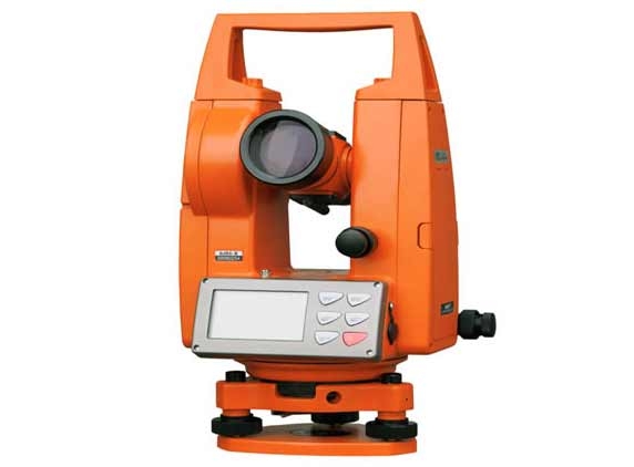
Theodolite the popular brand of professionals surveying tools which has been used since 2008 has now entered the smart channel. That's right! Now you can own the Theodolite app on your iPhone, iTouch, iPad or any Android phone to make use of the compass, GPS, map, rangefinder, and two-axis inclinometer to find the angles of elevation.
Such an app would be extremely useful for engineers, surveyors geologists, hikers and you now need not carry all the heavy equipment all over with you. In addition, the longitude, latitude, altitude, azimuth, address (if available), date and time, and horizontal and vertical angles are displayed over the camera UI with real time response. You can also chose to take a photograph with the details printed on the photo if you desire to do so. Proximity of a specific object on your camera image can be measured along with the elevation, angle of elevation and the direction apart from the longitude and latitude coordinates if you have a GPS and a data plan enabled. Hence, the device can be extremely handy for hikers and bikers, golfers trying to determine distances to holes, hunters, and travelers in boats and cars.
The application also supports sharing the details with social networking sites, of emailed to a friend. You can sync the data to a website which can be accessed from anywhere at anytime. In case of a network being unavailable, the data is stored on your phone until internet can be accessed.
iPad has a dedicated HD application, Theodolite HD with a better interface for the larger screen. The free application for the iPhone and the Android devices is available at the App Store and Google Play Stores respectively.
(AW- Anil)


